

New reporting suggests Iran may have used Chinese satellite imagery to monitor U.S. bases, highlighting how access to space-based data is increasingly influencing how targets are identified and tracked in modern warfare.
Chinese satellites in Iran’s strike capabilities
Chinese satellites in Iran’s strike capabilities
By The Beiruter | April 22, 2026

Reading time: 4 min
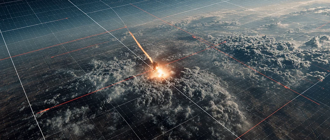
Recent reporting suggests that Iran may have used Chinese commercial satellite systems to monitor U.S. military positions across the Middle East. The claim, while disputed, has drawn attention not because of a confirmed transfer of weapons, but because of the type of capability involved.
Rather than missiles or drones, the focus is on access to high-resolution satellite imagery, often marketed as civilian but increasingly embedded in military use. The issue is not whether such systems directly guided strikes, but how this kind of data shapes the identification, tracking, and monitoring of targets over time.
What the reporting shows
An investigation by the Financial Times found that Iran had acquired access to a Chinese-built Earth observation satellite system in 2024 and used imagery from Chinese providers to track U.S. bases across the region, including in Saudi Arabia, Iraq, Jordan, and the Gulf. The system, originally designed for civilian purposes, reportedly provided imagery detailed enough to observe aircraft deployments and infrastructure layouts. U.S. officials cited in the reporting expressed concern that this access improved Iran’s ability to identify and monitor potential targets over time.
The allegation remains contested. President Trump said he had received assurances from President Xi that China was not supplying weapons “throughout this conflict.” China rejected the claims, describing the reports as “untrue” and accusing unnamed actors of “fabricat[ing] rumours [to] maliciously link them to China,” according to a foreign ministry spokesman. While the reporting does not establish that Chinese systems directly guided strikes, it points to how access to satellite imagery may shape how targets are identified and monitored in modern warfare.
The sensitivity of such data has already surfaced elsewhere in the conflict. Companies including Planet Labs and Maxar Technologies have in past conflicts adjusted the timing and distribution of high-resolution imagery over active war zones, citing concerns that it could be used for operational targeting.
Commercial systems, operational use
Satellite imagery has long been part of military intelligence. What has changed is the scale and frequency at which it can be accessed.
A 2025 study by the RAND Corporation shows that commercial satellite services, including remote sensing data from private providers, are now routinely integrated into intelligence, surveillance, and reconnaissance (ISR) missions.
Commercial imagery now offers both higher volume and frequency. New satellite constellations allow the same location to be imaged multiple times per day, creating a near-continuous record of activity rather than a single snapshot. This allows military users to track changes in activity over time, including aircraft movements, equipment buildup, and shifts in operational patterns.
High-resolution systems can capture imagery detailed enough to distinguish aircraft types, monitor runway usage, and detect changes in base activity across repeated passes. RAND also notes that commercial imagery supplements national intelligence systems, allowing them to focus on more sensitive targets. In that sense, it is integrated into existing military workflows rather than operating separately.
Similar conclusions are reflected in analysis by the International Institute for Strategic Studies, which finds that the growing availability of commercial satellite imagery is expanding access to battlefield intelligence beyond traditional state actors. At the same time, this reliance introduces risk. As commercial space services become more embedded in military operations, they also become more attractive targets, meaning disruptions could affect operational effectiveness depending on how central they are to a given mission
From observation to targeting
That shift in visibility has implications beyond observation. A separate RAND assessment of China’s military space capabilities draws a more direct connection between satellite imagery and military operations. The report describes how China has developed a large constellation of satellites designed to support intelligence collection and targeting.
According to the report, these systems contribute to multiple stages of military activity. They can be used to identify and track assets, support strike planning, and assess damage after an attack. This places satellite imagery within the broader operational cycle, rather than limiting it to passive observation.
The report also highlights China’s model of “civil-military” integration, in which commercial and state-linked actors operate within the same ecosystem. Technologies developed for civilian use, including Earth observation and geospatial analytics, can contribute to military capabilities even when not explicitly designed for them. In that context, systems marketed as commercial can still provide data that is relevant for monitoring military installations, tracking movement, and assessing activity patterns.
A different kind of advantage
Satellite imagery does not replace other forms of intelligence, but its increased availability and frequency are expanding its role in how the battlefield is understood. The reporting on Iran and Chinese satellite imagery fits within that broader pattern.
Even without definitive evidence that such systems directly guided strikes, it reflects how satellite data is already used in military contexts, where the ability to observe activity across locations at short intervals allows for more continuous monitoring of targets and rapid decision-making.
-
-

-
The Beiruter
-
