

GPS interference across the Gulf is exposing a critical vulnerability in the Israel–Iran war.
GPS warfare in the Israel–Iran conflict

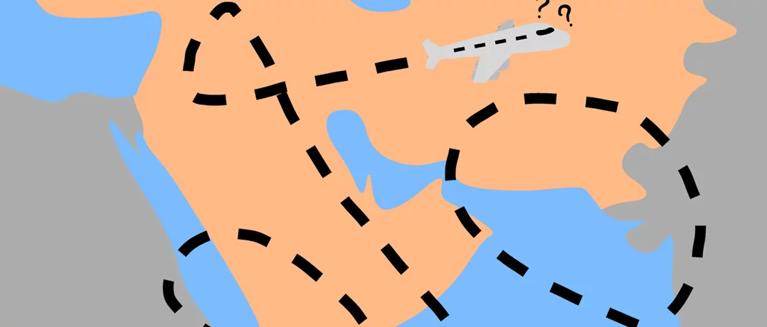
In the opening phase of the Israel–Iran war, GPS interference disrupted more than 1,100 vessels in a single 24-hour period in the Arabian Gulf. According to maritime intelligence firm Windward, ships transmitted false positions, appearing inland or clustering in implausible patterns consistent with spoofing, the transmission of false GPS signals, rather than conventional signal loss.
While no actor has publicly claimed responsibility, the scale and consistency of the disruptions point to deliberate interference consistent with state-level capabilities in the region. Subsequent reporting indicates the disruption did not dissipate, but persisted through the first month of the conflict. This interference has since reduced the reliability of navigation across the Gulf.
A contested navigation environment
Global Navigation Satellite Systems (GNSS), the satellite infrastructure that underpins GPS, aviation routing, and maritime navigation, have emerged as a central vulnerability in the conflict.
While the most acute disruptions were recorded in early March 2026, maritime security advisories indicate that interference has continued at scale. Updates from the Joint Maritime Information Center (JMIC) and UK Maritime Trade Operations describe persistent GNSS disruption across the Strait of Hormuz, the Gulf of Oman, and the wider Arabian Gulf, suggesting that interference has not receded with the initial phase of escalation.
These advisories also point to immediate navigational risks. Vessels transiting the Strait of Hormuz have reported sudden positional offsets of several nautical miles and, at times, a complete loss of reliable navigation data, forcing crews to revert to radar, visual navigation, and manual charting. In practice, this reduces one of the world’s most heavily trafficked shipping lanes to pre-digital navigation conditions.
Sustained and structured disruption
In some cases, the scale of interference has intensified. Subsequent analysis by Windward found that as many as 1,650 vessels were affected in a single day, a sharp increase from earlier levels. JMIC reporting has also documented hundreds of GNSS interference incidents within 24-hour periods. Taken together, these patterns suggest that GPS interference is no longer confined to discrete moments of escalation, but has become a persistent feature of the conflict in the Gulf.
Recent academic research helps clarify the nature of these disruptions. A 2026 study published by Cornell University finds that large-scale GPS spoofing can be identified through anomalies in vessel tracking data, including ships following physically impossible routes or appearing in coordinated clusters inconsistent with real-world navigation.
These same signatures have been observed in the Gulf during the current conflict, suggesting that the disruption is not incidental but the result of deliberate interference. The concentration of disruptions near Iranian waters and across the wider Gulf points to capabilities most plausibly associated with regional state actors, including Iran and Israel.
Historical precedent and escalation
The use of GPS interference in the region predates the current phase of the conflict but has intensified in both scale and frequency.
During the June 2025 escalation between Israel and Iran, GPS interference was already being reported across multiple domains, with maritime advisories documenting widespread jamming and spoofing affecting vessels in the Persian Gulf and eastern Mediterranean. A Bloomberg investigation published later that year described how these incidents exposed vulnerabilities in global navigation systems, with spoofing distorting vessel tracks and forcing operators to revert to manual or backup navigation methods.
These developments built on earlier precedents. Russia’s sustained use of GPS spoofing in Syria throughout the late 2010s, documented in a 2019 report by the Washington-based think tank Center for Advanced Defense Studies (C4ADS), demonstrated how electronic interference could be used to degrade adversary targeting capabilities and protect high-value assets.
The current conflict, however, differs in its geographic scope. Rather than remaining localized around specific military objectives, GPS interference is now affecting major commercial corridors, including the Strait of Hormuz, one of the world’s most critical energy corridors, increasing the risk of misrouting and collision in densely trafficked waters.
The strategic implications
The growing use of GPS jamming and spoofing reflects a shift in how modern conflicts are conducted. Control of the electromagnetic spectrum has become a consequential dimension of warfare, enabling actors to disrupt logistics, obscure movement, and introduce uncertainty into both military and civilian systems.
In the Israel–Iran conflict, this shift is especially significant. The Strait of Hormuz is not only a geographic chokepoint but now also an electronic one, where disruptions to navigation extend beyond regional security to affect international trade and energy markets. In a corridor this critical, even small disruptions can produce disproportionate global effects.
-
-

-
The Beiruter
-
