

Lebanon’s compact geography places it at the center of regional conflicts, where borders, cities, and front lines lie just hours apart.
The geography of war

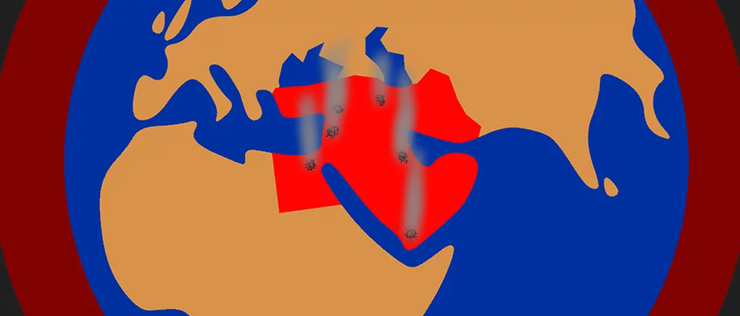
The scale of the current conflict can be difficult to visualize. Maps of missile strikes, troop movements, and regional retaliation stretch across thousands of kilometers, linking Iran, Israel, Lebanon, and the Gulf.
From Lebanon’s perspective, however, the geography appears very different. The country’s entire territory can be crossed in a matter of hours, and major cities such as Beirut and Tripoli sit within short driving distance of the expanding fronts along Lebanon’s southern and eastern borders, at times becoming front lines themselves. Borders with both Israel and Syria place the country squarely within a widening regional conflict.
The conflict is therefore closely tied to Lebanon’s geography as a small country situated between actors whose military reach extends well beyond their borders.
Mapping the war from Lebanon
Lebanon’s small territory
The geographic scale of Lebanon is essential to how the conflict unfolds within its borders. Lebanon covers just 10,452 square kilometers (4,036 square miles), roughly the size of the U.S. state of Connecticut. In global terms, that makes it extremely small. California alone is about 39 times larger than Lebanon. In Europe, Belgium is roughly three times larger, while France is more than 60 times its size.
The country’s narrow shape further compresses its geography. Lebanon stretches just over 200 kilometers (about 125 miles) from its northern border to its southern tip. Under normal conditions, that distance can be driven in about three hours.
Because of this limited scale, developments that might appear to be unfolding in vastly different regions of the country are in reality separated by only a short distance.
The southern front and Dahiyeh
Lebanon’s proximity to Israel, and the short stretch separating downtown Beirut from Dahiyeh, is one of the defining geographic realities shaping the conflict.
The distance between Beirut and Tel Aviv is about 210 kilometers (130 miles), roughly the same as traveling between New York City and Boston in the United States or between London and Birmingham in the United Kingdom.
Within Lebanon itself, the southern frontier is even closer. The drive from Beirut to the Israeli border is just over 100 kilometers (62 miles), typically around two hours by car. The coastal city of Saida (Sidon), where Israeli strikes were reported just today, lies just under 50 kilometers (31 miles) south of Beirut, roughly a one-hour drive.
Even inside the capital region, distances remain remarkably compact. Dahiyeh, the southern suburb of Beirut that has repeatedly been targeted in Israeli airstrikes during the current escalation, lies only 5 kilometers (3 miles) from downtown Beirut. That is roughly the distance between The Metropolitan Museum of Art and Union Square in New York, between the Louvre and the Place de la Bastille in Paris, or between Westminster and the British Museum in London.
The proximity became especially clear on March 5, when Israel issued evacuation warnings for several neighborhoods in Beirut’s southern suburbs ahead of anticipated strikes. The warnings triggered a mass exodus out of Dahiyeh as residents hurried north before the attack began. For people living in central Beirut, the episode carried an unmistakable message: the threat of strikes now loomed only a few kilometers away.
The Litani line
The next major geographic reference point in the conflict lies farther south along the Litani River. Earlier this week, Israel issued evacuation orders covering the entire area south of the Litani River, instructing residents to move north as ground operations intensified near the border. The Litani flows westward across southern Lebanon before emptying into the Mediterranean Sea and has long served as a significant geographic dividing line in the conflict.
The territory covered by the evacuation order amounts to roughly 8 percent of Lebanon’s total land area. In geographic terms, this represents an exceptionally large share of the country’s territory. By comparison, 8 percent of the United States would correspond to an area roughly equivalent to the size of Texas, while 8 percent of the United Kingdom would encompass territory comparable to the entirety of Wales. In a country as geographically compact as Lebanon, an evacuation order of this magnitude effectively alters a substantial portion of the national landscape.
The eastern corridor: Syria
Lebanon’s geography is shaped not only by its southern border with Israel but also by its long eastern frontier with Syria.
The two countries share a border stretching roughly 375 kilometers (233 miles), much of it running along the Anti-Lebanon mountain range. For decades, Syria had served as Lebanon’s primary land link to the broader Middle East. Major roads cross the Beqaa Valley toward Damascus and beyond, forming a corridor that connects Lebanon to Iraq and Iran.
Recent developments in the conflict have drawn attention to this eastern corridor as well. On Tuesday, Syria deployed thousands of troops and military equipment along its border with Lebanon, raising concerns that the conflict could spill further across the region’s interconnected frontiers.
The move highlights how Lebanon’s eastern border can quickly become another pressure point in a widening regional conflict.
Iran and the Gulf
While Israel borders Lebanon directly and Syria lies immediately to the east, the conflict now stretches far beyond Lebanon’s immediate neighborhood.
Iran, the center of this regional confrontation, lies far to the east of Lebanon but remains closer than many might expect. The distance from Beirut to Tehran, for instance, is roughly 1,450 kilometers (900 miles), comparable to traveling between Paris and Kyiv in Europe or between New York and Miami in the United States.
In recent days, Iranian strikes have also targeted Saudi Arabia, Qatar, and the United Arab Emirates, extending the geographic scope of the confrontation across the Gulf. Though these countries do lie farther from Lebanon, they remain relatively close on a regional map.
Riyadh sits about 1,300 kilometers (810 miles) from Tehran, roughly the distance between Paris and Vienna in Europe. Doha lies around 1,200 kilometers (745 miles) away, similar to traveling between Chicago and Atlanta in the United States. Farther east, the Gulf’s largest commercial hubs remain relatively close as well: Dubai and Abu Dhabi are just over 1,200 kilometers (about 750 miles) from Tehran, comparable to the distance between Berlin and Rome in Europe or between New York and Chicago in the United States.
On a regional map, Iran and the Gulf may appear distant from Lebanon, but the region’s capitals remain separated by only a few thousand kilometers.
War at close range
Understanding the war through Lebanon’s geography changes the scale of the map. What appears distant when reported in headlines often lies only a short drive apart within the country itself. That compressed landscape leaves little space between the borders, the capital, and the wider region’s front lines. In Lebanon, the geography of the war is never very far away.
-
-

-
The Beiruter
-
