



Sinking land is accelerating the effects of rising seas, but differences between neighborhoods are complicating efforts to measure flood exposure and protect vulnerable communities.
The world’s cities are sinking, but not at the same rate
The world’s cities are sinking, but not at the same rate
By The Beiruter | October 30, 2026

Reading time: 5 min
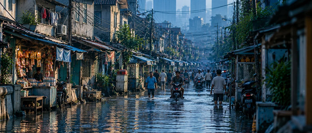
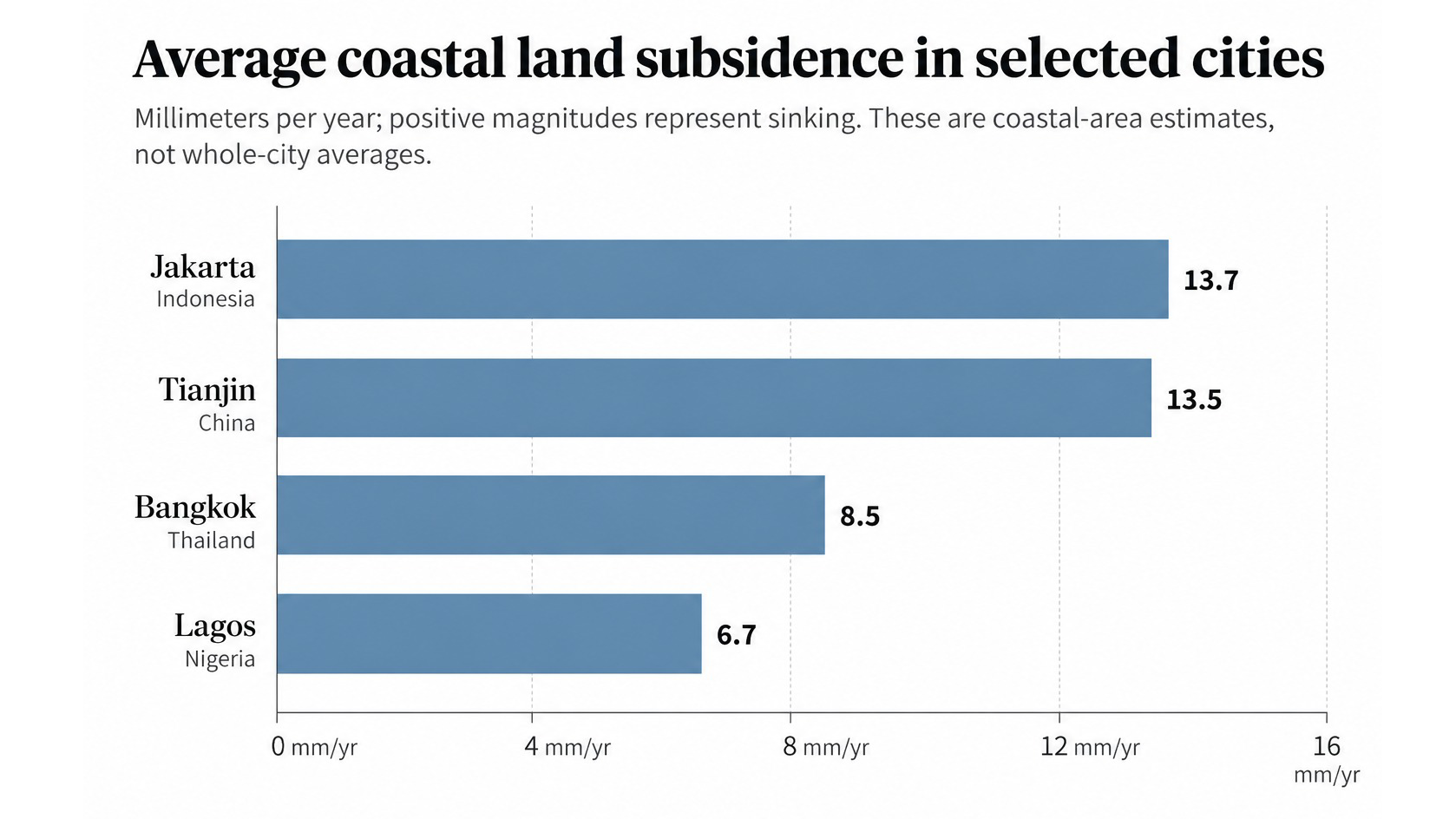
In the sprawling Indonesian capital of Jakarta, the ground beneath some neighborhoods is sinking more than three times faster than the city's coastal average. While parts of the city are dropping by as much as 42 millimeters annually, others are actually rising, creating vastly different levels of exposure to flooding within the same metropolis. Jakarta is hardly alone. Across the world, cities are gradually losing elevation as excessive pumping of underground water, geological processes, and expanding urban development cause the land beneath buildings and roads to sink. According to an April 2026 study published in Nature Communications, a peer-reviewed scientific journal, 71% of the global population living in low-elevation coastal zones resides in areas experiencing land subsidence, the gradual sinking of Earth's surface. For these communities, climate change presents a compounding threat. Rising seas are already increasing coastal flood risks, but sinking land compounds the danger, leaving some neighborhoods far more exposed than others and complicating government efforts to protect vulnerable communities. The relationship between sinking land and rising seas varies considerably across the world's coastal cities. The Nature study found that coastal populations experienced an average relative sea-level rise of approximately 6 millimeters annually between 1995 and 2020, roughly twice the climate-driven absolute increase. Subsidence accounted for approximately 2.8 millimeters of that annual change, compared with 3.15 millimeters attributable to rising ocean levels. Regional disparities were particularly pronounced across Asia and Africa. Jakarta recorded average coastal subsidence of 13.7 millimeters annually, followed by China's Tianjin at 13.5 millimeters, Bangkok at 8.5 millimeters, and Nigeria's Lagos at 6.7 millimeters. Source: Oelsmann et al., “Subsidence more than doubles sea-level rise today along densely populated coasts,” Nature Communications (2026). As in Jakarta, sinking rates also varied considerably between neighborhoods in Bangkok and Ho Chi Minh City, demonstrating the limitations of treating entire metropolitan areas as geographically uniform. These differences carry considerable implications for flood defenses. Infrastructure designed around average rates of sinking may underestimate exposure in particular districts, leaving some communities considerably more vulnerable than municipal projections indicate. Human activity is an important driver of sinking land, particularly where cities depend heavily on water pumped from beneath the Earth's surface. As explained in UNESCO's 2022 World Water Development Report, extracting underground water can reduce the pressure supporting surrounding soil and sediment, causing those materials to compress and the land above them to sink. In some geological conditions, the resulting loss of elevation can be irreversible. The process is particularly consequential in densely populated river deltas, where soft sediments and intensive water consumption create conditions favorable to sinking land, according to the 2026 Nature Communications research. The study estimated average annual subsidence of 7.8 millimeters across the Nile Delta, 5.6 millimeters in the Mekong Delta and 5.4 millimeters in the Ganges-Brahmaputra Delta. Yet groundwater extraction is not the only explanation. Tectonic activity, natural sediment compaction, and the gradual movement of Earth's crust as it continues to recover from the weight of glaciers that melted thousands of years ago also influence land movement. A May 2025 study published in Nature Cities examined land subsidence across 28 major American cities, including a more detailed analysis of groundwater measurements in 13 of them. Researchers identified a strong relationship between falling underground water levels and sinking land in certain geological formations where water is trapped between relatively impermeable layers. These differences complicate regulatory responses. Reducing groundwater withdrawals can slow sinking in susceptible areas, but historical compaction and local geological conditions may continue influencing land movement long after extraction patterns change. Sinking land also threatens inland cities. Using satellite observations collected between 2015 and 2021, the same Nature researchers estimated that approximately 33.8 million people lived on sinking land across the 28 cities, with at least 20% of the urban area experiencing subsidence in every city studied. Houston emerged as a particularly vulnerable metropolitan area. Approximately 42% of its land area was sinking faster than 5 millimeters annually, while 12% experienced rates exceeding 10 millimeters. The consequences are not limited to flooding. Uneven ground movement can damage foundations, roads, bridges and underground infrastructure, particularly when adjacent sections of a building settle at different rates. Across the 28 cities, researchers identified more than 29,000 buildings in areas classified as facing high or very high damage risk. Importantly, damage risks were not necessarily greatest where land sank fastest. Uneven movement between adjacent areas could threaten infrastructure even where average elevation changes remained modest. Advances in satellite monitoring are providing researchers with an unprecedented understanding of land movement, exposing geographical differences that earlier measurement systems frequently overlooked. The 2026 global study combined satellite radar, ground measurements and other observations to estimate subsidence across coastal regions containing nearly 65% of the world's low-elevation coastal population. Such measurements offer governments an opportunity to identify vulnerable districts more precisely and incorporate land movement into infrastructure planning. Yet monitoring alone cannot prevent damage. Effective responses require groundwater regulation, sustained investment in drainage and flood defenses, and planning policies sensitive to local geological conditions. The stakes are particularly high in rapidly urbanizing regions, where population growth, infrastructure demands and dependence on groundwater can intensify existing vulnerabilities. As climate-driven sea-level rise continues, cities will face mounting pressure to address the movement of the land beneath them. Without policies that account for differences between neighborhoods, even substantial investments in flood protection could leave the most exposed communities inadequately protected.A threat concealed by averages
The groundwater connection
The infrastructure beneath the surface
Can cities keep pace?
-
-

-
The Beiruter
-
