



The UN General Assembly endorsed the “Correct the Map” initiative, promoting more accurate world maps and equitable global geographical representation, especially with regards to Africa.
UN pushes for a more accurate picture of the World
UN pushes for a more accurate picture of the World
By The Beiruter | September 08, 2026

Reading time: 5 min
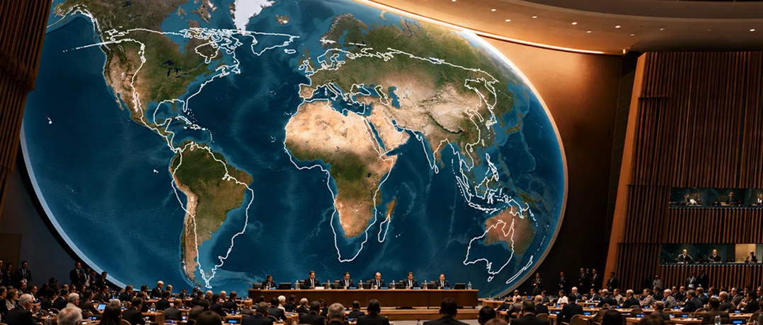
The United Nations General Assembly (UNGA) concluded the substantive work of its 18th session on 8 September 2026 by adopting a series of resolutions. Among the most notable decisions was the adoption of the “Correct the Map” resolution, an initiative led by African states that encourages broader use of equal-area world map projections to provide a more accurate representation of the size of continents, particularly Africa.
Although the resolution is not legally binding, it reflects growing international discussions about how cartographic representations shape education, public understanding, and global perceptions.
UN endorses more accurate world maps
The General Assembly adopted the resolution titled “Correct the map: rebalancing global cartographic representation and promoting equitable representation of the world’s regions, particularly Africa” by a vote of 164 in favor, 1 against, and 6 abstentions.
The United States (U.S.) cast the only vote against the measure, while Estonia, Georgia, Lithuania, the Republic of Moldova, Serbia, and Ukraine abstained.
The resolution encourages governments, educational institutions, publishers, international organizations, and digital platforms to make greater use of equal-area map projections when illustrating the relative size of continents. It specifically highlights the Equal Earth projection, introduced in 2018, as an appropriate option for educational and informational purposes where accurately depicting land area is important.
Importantly, the resolution does not prohibit the continued use of the Mercator projection. Instead, it recognizes that different map projections serve different purposes and recommends wider adoption of equal-area projections in contexts where geographical scale matters.

The United Nations General Assembly adopted a resolution titled "Correct the map: rebalancing global cartographic representation and promoting equitable representation of the world’s regions, particularly Africa" by a recorded vote of 164 in favour to 1 against (United States), with 6 abstentions (Estonia, Georgia, Lithuania, Morocco, Serbia, and Ukraine).
Why the Mercator projection has been criticized
The Mercator projection was created in 1569 by Flemish cartographer Gerardus Mercator primarily for maritime navigation. Its mathematical design preserves compass bearings and local shapes, making it highly effective for sailors navigating long distances.
However, because the projection stretches areas closer to the Earth’s poles, it significantly enlarges high-latitude regions while compressing areas nearer the equator.
As a result, Greenland appears nearly as large as Africa despite Africa being roughly 14 times larger, Europe, Russia, Canada, and other northern regions appear disproportionately large, while Africa, South America, and parts of South Asia appear considerably smaller than their actual land area.
Although geographers have long understood these distortions, the Mercator projection became the standard world map used in classrooms, textbooks, atlases, and later digital mapping applications because of its practical navigational advantages and widespread historical adoption.
The Equal Earth projection seeks to preserve the true relative surface area of continents while maintaining an aesthetically familiar appearance, offering a compromise between accuracy and readability.

A comparison of the 1569 Mercator and the Eckert IV maps Illustration: French foreign ministry
Africa’s campaign to “Correct the Map”
The initiative originated within the African Union (AU), which endorsed the Equal Earth projection before requesting Togo to lead negotiations at the United Nations (UN).
Presenting the resolution on behalf of the African Group, Togo argued that maps are not merely technical tools but also influence how societies understand geography, history, development, and international relations.
Supporters maintained that repeated exposure to distorted world maps has contributed to an understated perception of Africa’s geographical scale and, by extension, its demographic, economic, and strategic importance.
The resolution links more accurate cartographic representation to concepts such as cognitive justice, historical recognition, and equitable global representation. Its sponsors stressed that the initiative is not intended to criticize historical cartographic traditions or any particular country, but rather to encourage greater accuracy where comparative land area is relevant. The representative of Togo asserted that
A fair map does not change the geography of the world; it changes how we see the world.
The campaign also reflects a broader effort by many African states to strengthen the continent’s visibility and representation within international institutions. The same representative added that
Correcting the map means recognizing that every region of the world deserves to be represented accurately and with dignity.

The 2018 Equal Earth Map. Illustration: equal-earth.com
Different international reactions
The resolution received broad international support from countries across multiple regions.
The European Union (EU) voted in favor while clarifying that the resolution applies solely to educational, awareness-raising, and geographical literacy purposes. The bloc stressed that it does not affect questions relating to sovereignty, territorial boundaries, or internationally recognized borders.
France also announced that it would gradually replace the Mercator projection in many official contexts with alternative projections that more accurately represent land area. French officials stated that improving cartographic accuracy aligns with recommendations from geographers and cartographic experts.
Russia supported the initiative, describing it as consistent with efforts to address historical imbalances inherited from colonialism and to strengthen Africa’s role in an increasingly multipolar international system.
The U.S. opposed the resolution, arguing that it represented an unnecessary and ideological initiative that diverted attention from more pressing international challenges. The U.S. delegation maintained that the General Assembly should prioritize issues directly affecting international peace, security, and development.
Meanwhile, Ukraine abstained, explaining that while it supported the general objective of improving cartographic accuracy, the Equal Earth projection referenced in the resolution depicted Russian-occupied Ukrainian territories in a manner inconsistent with previous UN resolutions regarding Ukraine’s internationally recognized borders.
Practical impact of the resolution
General Assembly resolutions are recommendations rather than legally binding obligations. Consequently, governments, schools, publishers, and technology companies are not required to replace existing maps.
Nevertheless, the resolution is expected to influence educational materials, academic publications, and international organizations over time. Several countries have already announced plans to revise classroom materials, while discussions are underway regarding broader adoption of equal-area projections in educational and public information settings.
The resolution also encourages cooperation between member states, regional organizations, scientific institutions, and technology companies to promote more accurate cartographic representation where appropriate.
At the same time, it explicitly recognizes that projections such as Mercator remain suitable for specialized purposes, particularly maritime and aeronautical navigation, where preserving direction is more important than accurately depicting relative land area.
While the resolution does not replace the Mercator projection or mandate changes to existing maps, it provides international recognition of the importance of accurate spatial representation and is likely to shape future educational, institutional practices, historical perspectives, and representation.
-
-

-
The Beiruter
-
