



In the first installment of a three-part investigation, The Beiruter draws on archival records to trace the physical, economic, demographic and linguistic transformations that produced modern Dahiyeh, whose name would later acquire extraordinary political weight.
The making of Dahiyeh: An archival history
The making of Dahiyeh: An archival history
By Katharine Sorensen | August 20, 2026

Reading time: 10 min
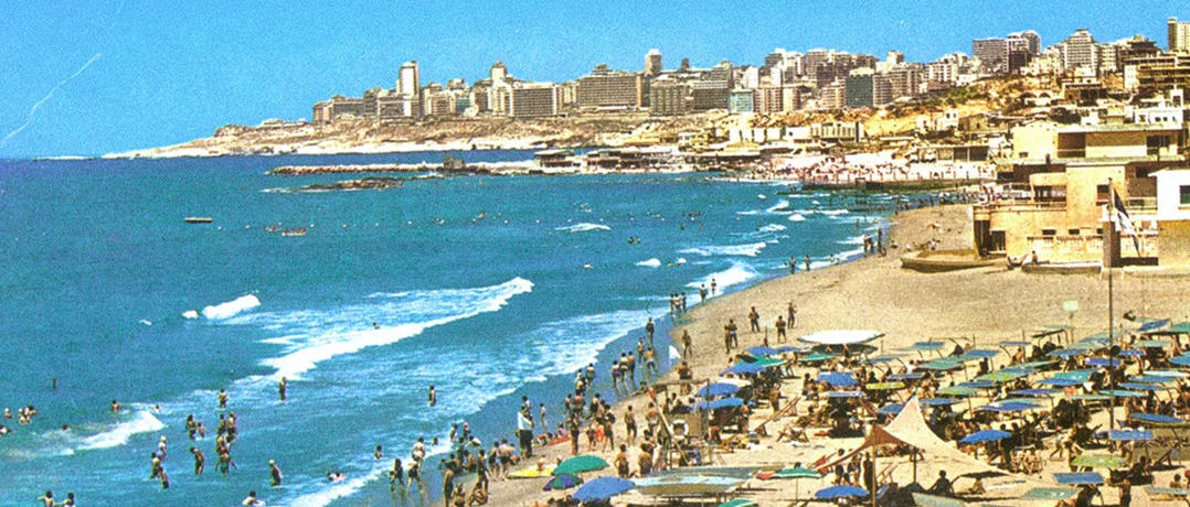
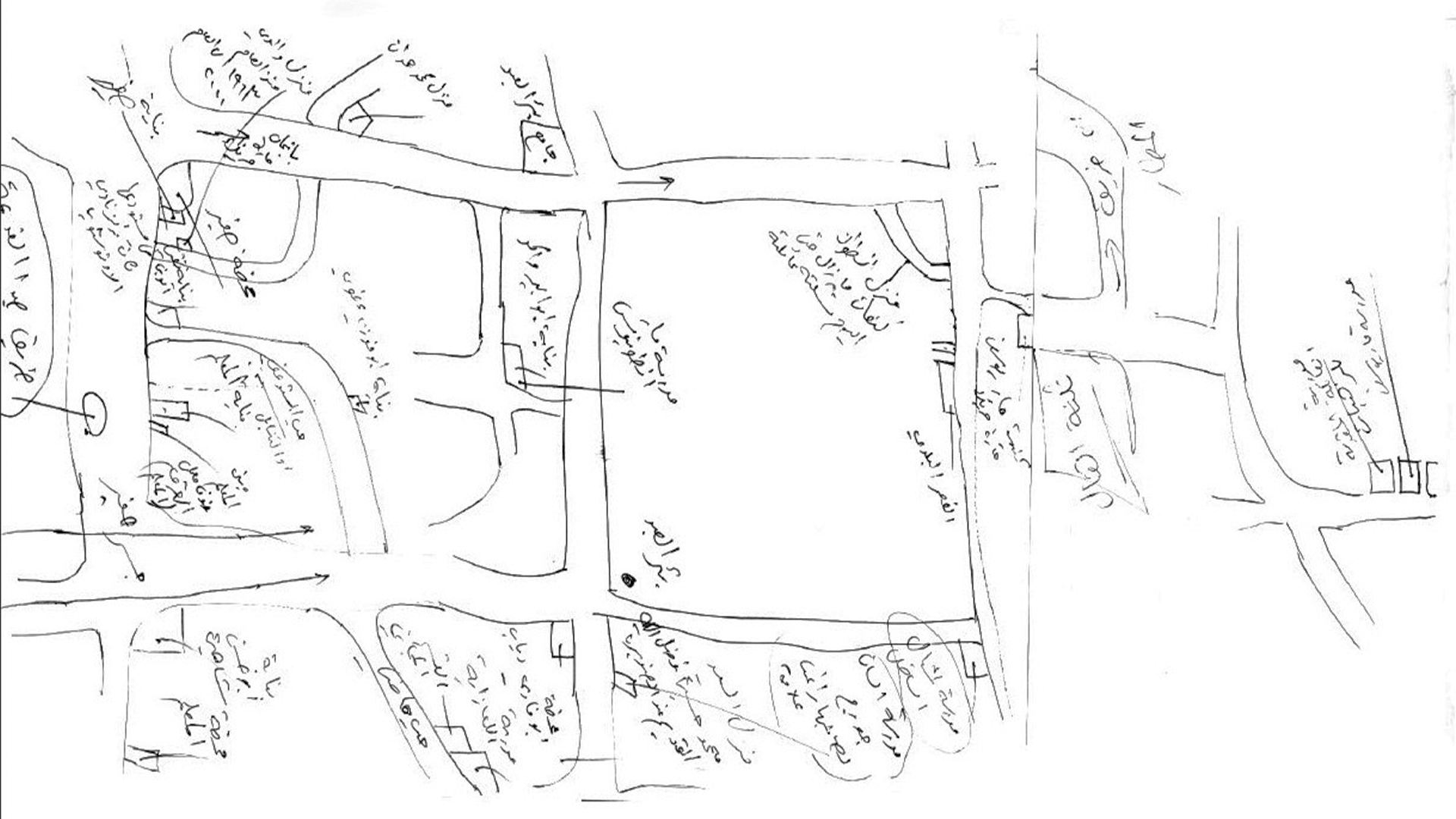
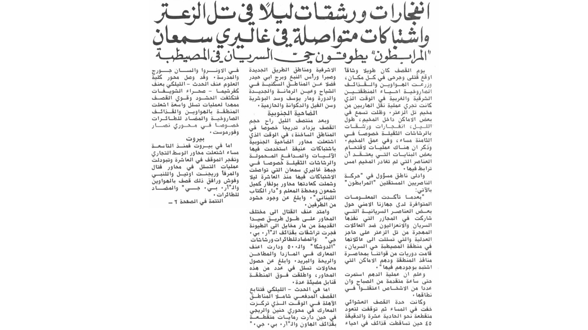
Among the photographs, newspaper clippings and personal records documenting Dahiyeh in a Beirut archive is a document from 1927 that offers an unfamiliar vision of the city’s southern suburb. Published that October in Al-Majalla al-Suriyya (The Syrian Magazine), an Arabic-language periodical covering political, economic and cultural affairs, the article announced plans for a large residential development south of Beirut. The proposal describes broad streets, parks and promenades, with private gardens surrounding individual homes. But gardens and promenades are not what the name Dahiyeh evokes today. Over the past quarter century, the name has become so politically charged that it can evoke Hezbollah, conflict and destruction before it evokes a physical place. Yet that political history is not where Dahiyeh begins. To reconstruct the making of Dahiyeh, The Beiruter examined photographs, planning proposals, newspapers, industrial directories and personal records preserved by UMAM Documentation & Research and the American University of Beirut. The archives point to a different history—one in which over several decades Dahiyeh underwent four interlocking transformations: physical, economic, demographic and conceptual. Open land became a continuous built environment, successive movements of people altered the population, agriculture gave way to construction and commerce, and historically distinct villages came to be understood as a single urban entity. The political history that would later make Dahiyeh internationally recognizable did not create the suburb. It inherited it. The word itself offers a deceptive answer. Dahiyeh is the Lebanese pronunciation of the Arabic word ضاحية, meaning "suburb." Short for al-Dahiya al-Janoubiyya—literally, "the Southern Suburbs"—the term is typically either retained in English as Dahiyeh alone or translated as "Beirut's southern suburbs." For many English speakers, "suburb" suggests a familiar image of white picket fences, manicured lawns, and neighborhoods set apart from a distinct urban center, often carrying assumptions of space and affluence. Beirut’s Dahiyeh bears little resemblance to that model. It is a highly dense urban extension of the capital, in places only a few kilometers and, without traffic, roughly 10 minutes from central Beirut. Its streets are crowded with apartment blocks, shops, schools, and religious institutions. While estimates of its population vary considerably—Lebanon has not conducted a national census since 1932—most place it somewhere between several hundred thousand and more than 600,000 residents. Even its geography is unsettled. Dahiyeh is neither a municipality nor an administrative district, but a cluster of municipalities and neighborhoods along Beirut's southern edge, centered on Haret Hreik, Ghobeiri, Burj al-Barajneh and Mreijeh–Tahwitat al-Ghadir in Baabda District and often extending to Ouzai and Bir Hassan. Because "Dahiyeh" is an urban and geographic designation rather than an official administrative unit, its boundaries continue to vary across government maps, academic studies, and media reporting. That ambiguity is not incidental, but central to the history of the place. Dahiyeh was never formally created as a single entity. It became one as Beirut expanded south. Behind the garden suburb described in 1927 was an ambitious land deal. Businessman Najib Pasha Chakkour had reached an agreement with landowners near the agricultural district of Bir Hassan to combine their properties with land already held by the Al-Mabahess Company, creating a tract of approximately five million square dhiraʿ, a historical unit of measurement. The owners would receive shares in the development company and become founding partners. The proposed town was designed to accommodate tens of thousands of residents. Its streets would be broad and paved. It would contain parks and promenades. Each house would have a private garden, giving residents access to fresh air and sunlight. Developers were negotiating to bring water to the area and hoped the electric tramway would eventually be extended there The proposal emerged at a moment when Beirut itself remained a relatively compact city. The French Mandate had only recently been established in 1923, and the municipality occupied only a fraction of today's metropolitan area. The magazine likened the project to "New Egypt," an apparent reference to Heliopolis outside Cairo. Developed by Belgian industrialist Édouard Empain beginning in 1905, Heliopolis had become one of the region's best-known examples of planned suburban development. There is an irony in the comparison. The English-language image of a "suburb" that seems so inappropriate to Dahiyeh today is remarkably close to what developers actually imagined for Beirut's southern outskirts in 1927. Their vision was low-density and residential, with broad streets, private gardens, open space and infrastructure planned in advance. Nearly a century later, the same word describes one of the most densely built parts of metropolitan Beirut. Yet to dismiss the 1927 plan as a failed curiosity would miss its significance. It shows that the southern outskirts were already being regarded as a frontier for Beirut's expansion decades before the civil war and the large-scale displacements often associated with the emergence of modern Dahiyeh. The direction of growth had been anticipated, even if its eventual form had not. The proposal also captures the economic transformation at an unusually early stage. The land remained agricultural, but its value was already being calculated according to what could be built upon it. Rather than selling their fields, property owners would contribute them to the development company in exchange for shares, converting agricultural holdings into stakes in future urban growth. The land was changing economically before the landscape changed physically. Evidence of that transition appears again in a 1950 Guide to Lebanon's Industries consulted by The Beiruter at the American University of Beirut's Jafet Library. Across entries for manufacturers as varied as paint, calcium carbonate and biscuits, the directory repeatedly listed factory locations as "Beirut City & its southern suburb." The wording is significant. By midcentury, the southern outskirts had become a recognizable industrial extension of Beirut. Yet urbanization remained uneven. A color postcard of the Jnah-Ouzai coastline from before the civil war shows hundreds of swimmers and sunbathers along beaches south of Beirut, with cafés, umbrellas and seaside facilities lining the shore. The postcard captures a coastline difficult to reconcile with the continuous urban landscape that now extends across Beirut's southern edge. The density now associated with Dahiyeh is, critically, historically recent. The southern outskirts were becoming part of metropolitan Beirut in part through the movement of people into them. A hand-drawn map preserved in UMAM's collection captures an earlier social geography. Nassib Saade, one of the residents who participated in the exhibition, reconstructed Haret Hreik as he remembered it in the 1950s, marking families, churches, businesses, gas stations and familiar routes. Rather than a continuous metropolitan suburb, the map depicts a place still understood through its residents, institutions and local landmarks. Hand-drawn map of 1950s Haret Hreik by Nassib Saade. Archival material from UMAM D&R's 2007 exhibition, "Collecting Dahiyeh." Nearly half a century later, those village identities remained vivid in residents' memories. In a 2002 interview published by Annahar, a prominent Lebanese daily newspaper, former minister and MP Mahmoud Ammar recalled the Burj al-Barajneh of his childhood, before the southern outskirts had become a continuous urban landscape. A native of the area, he recalled a period before the 1960s when villages, orchards and houses remained separated by open land. Community life centered on established families, local leaders and municipal institutions, with Christians and Muslims participating in many of the same civic and political networks. Stone houses, squares, schools and religious institutions gave each village a recognizable center. The interview complicates accounts of Dahiyeh that begin with the arrival of newcomers. Migration was unquestionably central to its growth, but it occurred within villages that already possessed histories, institutions and identities of their own. Beginning in the 1950s and accelerating through the 1960s, Shiite families from South Lebanon and the Bekaa settled in Beirut's southern outskirts in growing numbers. In a 2024 study of displacement and urban politics in Beirut, political scientist Amanda Rizkallah traces the first significant wave to the early 1950s, when unemployment and the economic marginalization of rural areas drew migrants toward the capital. An agricultural crisis in South Lebanon added further pressure by the mid-1960s. Palestinian refugees likewise settled around the southern suburbs after 1948, most notably in Burj al-Barajneh camp, established that year by the International Committee of the Red Cross and later administered by UNRWA. The civil war beginning in 1975 added another layer as Lebanese families displaced from elsewhere in the country moved into Haret Hreik, Ghobeiri, Burj al-Barajneh, Tahwitat al-Ghadir, Bir Hassan and neighboring areas. The war also drove residents out. Ammar recalled leaving Haret Hreik for Hazmieh in 1976 amid growing insecurity and described Christian property owners departing and later selling homes and land. Across the southern suburbs, the resulting demographic changes were substantial. Rizkallah found that Haret Hreik and Mreijeh, both majority Christian before the war, became majority Shiite during it, while Burj al-Barajneh and Ghobeiri retained their existing Shiite majorities. These movements had different causes, but together they altered the territory. Housing spread across previously open land, narrowing the physical separation between older villages even as their municipal boundaries remained intact. The collection of communities preserved in Saade’s map was becoming part of a continuous metropolitan landscape. The changes taking place across the southern outskirts were also producing a new geographic vocabulary. Historically, the area south of Beirut appeared under a variety of names. Mid-twentieth-century sources identified parts of it as Coastal Metn (al-Matn al-Sahili), reflecting their historical association with the Metn region rather than with Beirut. By 1950, Guide to Lebanon's Industries, a directory of Lebanese manufacturers, was instead referring to "Beirut City & its southern suburb." The designation suggests that economic geography was beginning to outrun administrative geography. The municipalities remained separate, but to an industrial directory cataloguing Beirut's economy, the territory south of the capital was already legible as a single metropolitan zone. A report published by Annahar on Aug. 13, 1976, during the first full year of the Lebanese Civil War, offers further evidence of that evolution. Its significance lies not only in the violence it records but in the geography its language assumes readers will recognize. Rather than identifying Haret Hreik, Ghobeiri, or Burj al-Barajneh individually, the newspaper grouped them under the collective heading al-Dahiya al-Janoubiyya ("the southern suburbs"). The shift in terminology framed the area as a single geographic entity rather than a collection of municipalities. 1976 Annahar report describing fighting across Beirut's "southern suburbs." Archival material from UMAM D&R's 2007 exhibition, "Collecting Dahiyeh." The report does not establish the first use of the expression, nor does it suggest that the civil war created Dahiyeh. It does, however, capture a moment when the collective label had entered mainstream journalistic language and no longer required explanation. Over time, even the qualifier al-Janoubiyya would increasingly fall away. Dahiyeh alone became sufficient—not simply a description of Beirut's southern suburbs, but the name of a place in its own right. By the end of the twentieth century, Dahiyeh had become more than a collection of municipalities on Beirut's southern edge. It had become a place recognizable to residents, journalists and the state alike—a shared geographic identity layered upon communities that had once been understood separately. The archives trace how Dahiyeh was assembled over decades. Agricultural land gave way to industry and construction, migration and displacement altered the population, and once-separate communities acquired a common name. But the meaning of that name continued to change. Political movements, war and reconstruction would transform Dahiyeh from a geographic identity into a political one. That transformation, and the forces that produced it, is the subject of the second installment of The Dahiyeh Dossier.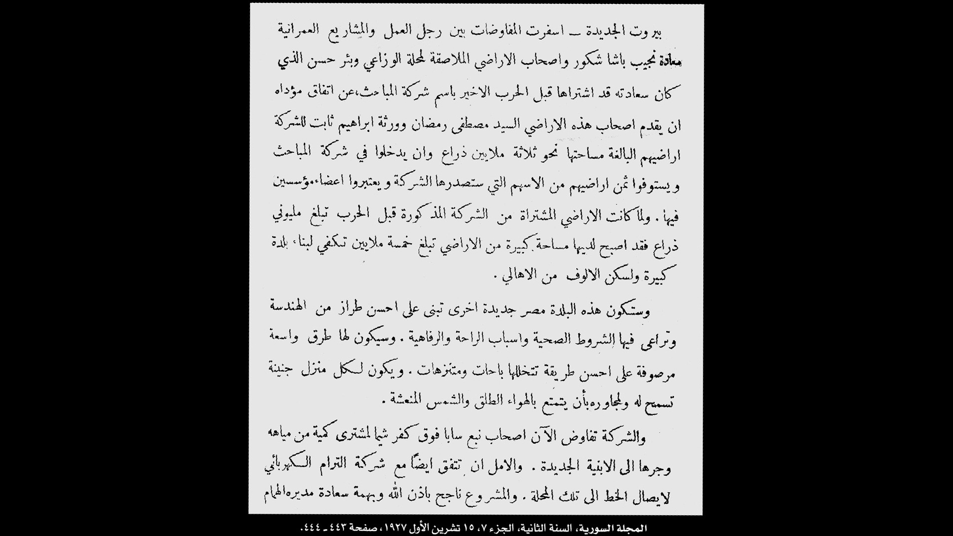 1927 Al-Majalla al-Suriyya article outlining the proposed "New Beirut" (بيروت الجديدة) development. Archival material from UMAM Documentation & Research's 2007 exhibition, "Collecting Dahiyeh."
A misleading name
The value of land: the physical and economic transformation
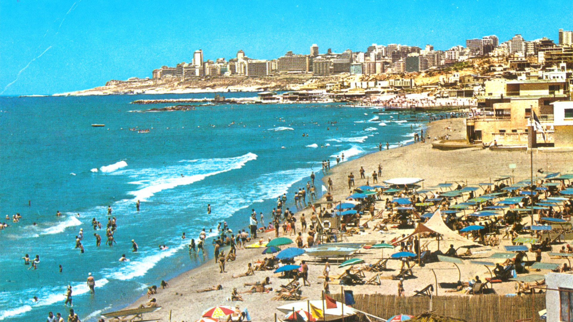 Jnah-Ouzai coastline before the Lebanese Civil War. Archival material from UMAM D&R's 2007 exhibition, "Collecting Dahiyeh."
A changing population: The demographic and social transformation
Inventing “Dahiyeh”
-
-
-
Katharine SorensenReporterSpecializing in global affairs, technology and economics, with a focus on on-the-ground investigative reporting.
-
